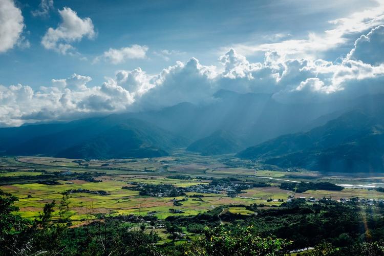
Taitung Mountain
Overview
The main peak Newport mountain is 1682 meters above sea level, located in the middle part of the mountain range. Xiu Junxi flows out of the middle section, divides the mountains into the north and south, the northern section accounts for 1/3 of the total length of the total, with an average level of about 500 meters, the highest point of cat is 922 meters; the average slope is about 15 degrees, the mountain It is not steep, but it can be climbed. There are more cliffs in the south section, the mountains are steep, with an average of about 1000 meters, climbing difficult.
Taitung Mountain (3 photos)
The southern part of the east side of the mountain is more cliffs, the mountain is steep, there are two highways. On the coast of the YANGo, the Taitung Mountain is directly in the coast, forming a steep Taiwan island east coast.
Taitung Valley
The west side of the Taitung Mountain and the central mountains and the central mountain range are famous Taitung Valley, also known as the Valley Plain, 50-250 meters above sea level, 150 kilometers long, average 8 kilometers wide, there is a railway, highway, and there is a horizontal road to the west, but the two sides of the valley wall, a mountain flood, and the traffic is interrupted.
Taidong Climate
Taiwan climate is warm and humid, and the general trees are evergreen a year. However, the Taitung Valley located on the west side of the coastal mountain, with the cold flow again and again, Qingshan Cui Vali Ye Huan Danhong, reflected in the sky, like a fire, divided into the eye, showing charming views. There are about 500 meters above sea level in the west side of the Taitung Mountains, which is distributed in a broad-leaved forest belt.
Taitung Mountains (3 photos)
Among them, Qingfeng and Fengxiang are the main red leaves, and other Taiwan beech. Taiwan, Huang Lianmu and the famous trees and other trees. When the leaves of these trees have come to the autumn and winter, they do not have to go from the green, dark red, orange red, and install the beautiful scenery of "Red Leaves". At this point, people often watch the red leaves in the Valley, and their vitality that is not afraid of fear is amazing. Some villages, streams, and hot springs in Taitung, and there is a village named by red leaves in Yanping Township and Hualien County in Ji Ping Township in Ji Valley. There is a stream named by red leaves. Each has a hot spring named after red leaves. Hongye Village, Yanping Township, Taitung County is also called "red leaf landscape" to recruit people.Related Village
Yanping Township Red Leaf Village, also called Hongye Society, in the west side of Huadong Highway, local residents belong to the Horses in the mountains, dominated by agriculture, scattered in the mountains Valley. The Red Leaf Village is situated on the reappears of Hongyuti, and most of its fan has been cut, forming a high and low, and called Red Ye Valley. The mountains and mountains around the Red Leaf Valley are full of Qingfeng and Bamboo, and the green water is like a wonderful picture. Whenever the late autumn season, the red leaves in the mountains and near the road and the roads on the road are covered with the clouds, and the wind is full of treetops, Shasha, and the two-phase accompaniment of the winding red leaf stream, like a piano, If a kite, I really don't have a charm.
Taitung Mountain (3)
"Red Leaf Sound" is listed as one of Taitung.Taitong scenery
Yilan, Hualien, Taitung San County, northbound, north to the south, east of the vast Pacific Ocean, while the coastal mountains showerped in Hualien, Taidong's beach, and the central The mountains are jealous and narrow Taitung Valley. This terrain is narrow, like a giant wall, blocks the huge waves from the Pacific Ocean to Taiwan Island.
is quite opposed to the West Coast Plains, which is the late region of Taiwan, and except for the Yilan Plain, which has been developed, most of the region is still a wild mountain wilderness. Here is the rare, and weigh the "monument" tour point, and natural scenery is also similar. However, the world-famous Qingshui Da Cliff and the Taorge Canyon are also in this area. Now, the South Turning Highway, Huadong Highway and Suhua Highway have also been made, and the main villages and towns of the three counties in Taiwan have almost all connected.
Latest: ALLIANCE
Next: Shangguan Park


